Maps & Guides
THINGS TO DO · MAPS & GUIDES

Every interactive map and area guide on the site in one place: trails, waterfalls, driftwood sculptures, docks, fishing spots, beaches and the neighbourhoods.

7 interactive maps · 8 area guides · Updated October 2026Things To Do Guide · Campbell River Guide
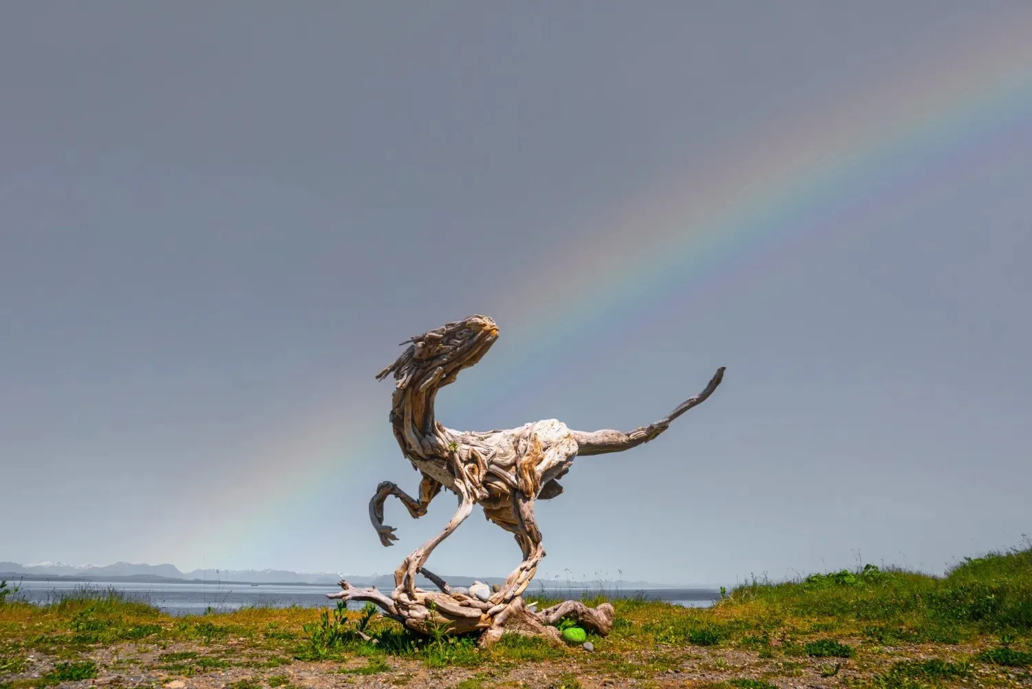
Photo: Sarah the Herrerasaurus on the Seawalk, Destination Campbell River

01AT A GLANCE

The details that matter.

Seven maps open straight onto the places, with photos, filters and directions. Eight area guides explain each part of the region first, then link to the full guide and its map.

Maps
Driftwood Sculptures, Hiking Trails, Waterfalls, Docks, Marinas & Launches, Fishing, Beaches, the whole region
Guides
Driftwood Sculptures, Hiking, Docks, Lakes & Rivers, Parks, Attractions, Neighbourhoods, Quadra Island
On a phone
Every map works, with "Use my location"

•AREA GUIDES

Read the guide first.

Eight guides to the region, each with a short intro. Open the full guide for every place, the map and the details.

Sights & Culture

Driftwood Sculptures

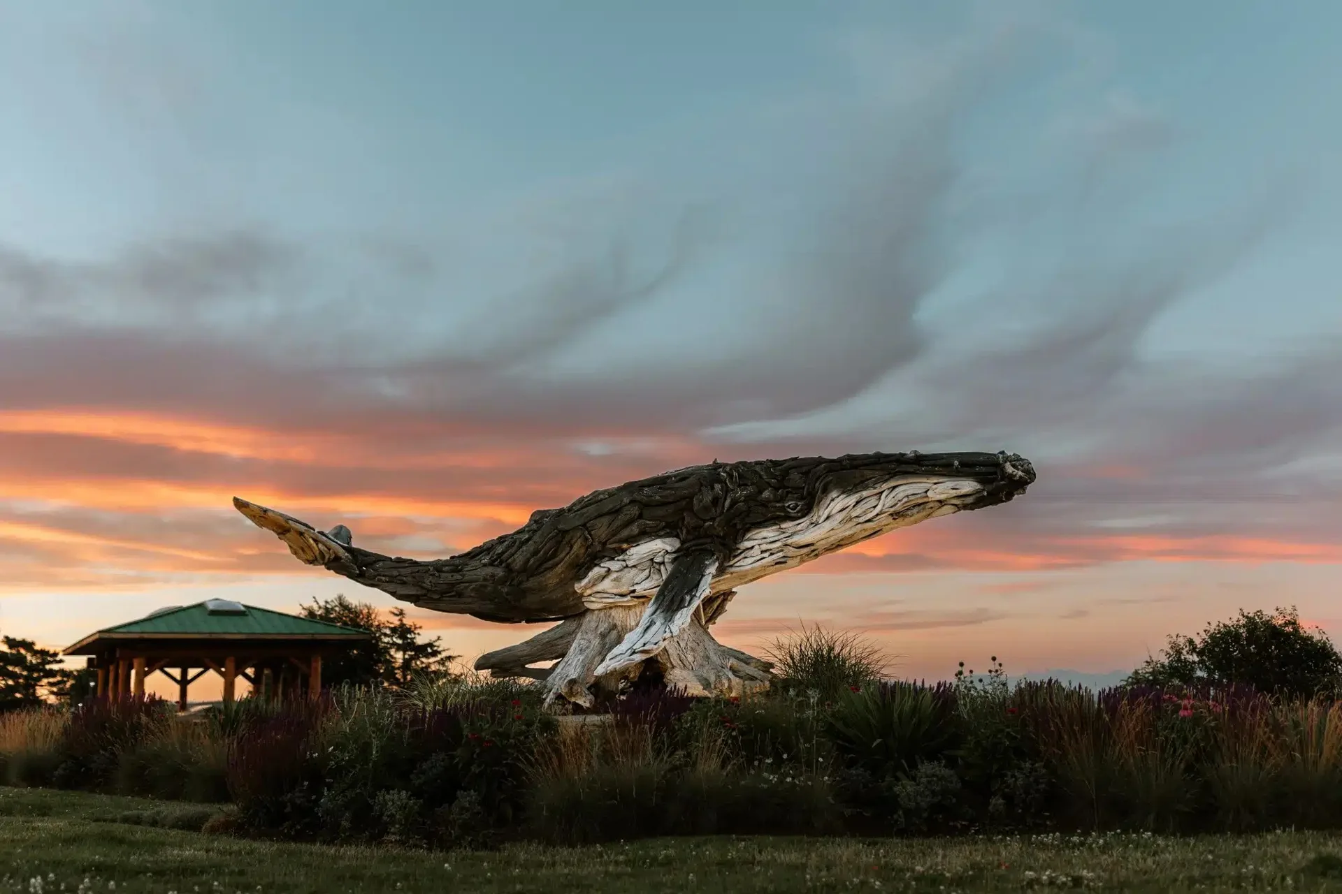
Local artist Alex Witcombe of Drifted Creations builds life-size animals out of beach driftwood, and many of them stand in public spots around town. Drift, a 9-metre humpback whale, is in Willow Point, Peabody the Raccoon and Sarah the Herrerasaurus are on the Seawalk, and Bruce the Bear stands at the end of Spruce Street in Campbellton. The guide shows how to find all 13, including the three on Quadra Island.
Read the full guide
Outdoors

Hiking

The easiest big view is the Elk Falls suspension bridge, about 800 m from the day-use area off Highway 28, hanging 64 m above the Campbell River. Longer days lead into Strathcona, the oldest provincial park in British Columbia, or across on the ferry to the trails on Quadra Island. The guide covers 24 trails, grouped by area, and every one is on the trail map.

Read the full guide
On the Water

Docks, Marinas & Boat Launches

Downtown has the marinas, the Harbour Authority wharf and the Discovery Fishing Pier, which opened in 1987 as Canada's first saltwater fishing pier. The City runs the ocean boat ramps at Big Rock and Ken Forde Park, and the lakes west of town have launches of their own. The guide lists moorage, fuel and launch details for each place, from town out to Quadra and Cortes.

Read the full guide
On the Water

Lakes & Rivers

The Campbell River and its tributary, the Quinsam, carry four of the five Pacific salmon species right through town. McIvor Lake Park, run by the City, has beach access, a boat ramp and trails. Further west along Highway 28, Upper Campbell Lake and Buttle Lake reach into Strathcona Provincial Park.

Read the full guide
Outdoors

Parks

The paved Seawalk follows Discovery Passage from the foot of 1st Avenue to Maryland Road, linking waterfront parks like Robert V. Ostler Park and Rotary Beach. Willow Point Park on South Alder Street is one of the city's largest, with a splash park, a playground and a skate park. Elk Falls Provincial Park, 2 km from downtown, adds a 25-metre waterfall, 6 km of trails and the riverside Quinsam campground.

Read the full guide
Sights & Culture

Attractions

The Museum at Campbell River on Island Highway covers First Nations cultures and the coastal history of the region. The Maritime Heritage Centre keeps BCP 45, the wooden seiner once pictured on the Canadian five-dollar bill, and the Seawalk passes the 50th Parallel Mark. On Quadra Island, the Cape Mudge Lighthouse stands at the island's southern tip.

Read the full guide
The Region

Neighbourhood Guides

The guide covers seven Campbell River neighbourhoods, from Willow Point at the south end to North Campbell River beyond the river mouth. Downtown is the main hub for shops, civic life and culture, with the fishing pier and the Quadra ferry a few flat blocks apart. Each neighbourhood page shows what is close by, from beaches and trails to the main streets.

Read the full guide
The Region

Quadra Island

Quadra is a 10-minute BC Ferries sailing from downtown Campbell River to Quathiaski Cove, where most of the island's shops and cafes are. Rebecca Spit Marine Provincial Park, near Drew Harbour on the east side, is a 2 km spit with sandy beaches on both sides. In the village of Cape Mudge, the Nuyumbalees Cultural Centre shares the history, art and traditions of the Kwakwaka'wakw people.

Read the full guide
YOUR NEXT CHAPTER STARTS HERE.LET’S CAMPBELL RIVER GUIDE ↗

Guide, outfitter or charter operator?
Show us your business.

We’ll help the right people find it.

Start free. No credit card. No website? Start here

•FAQ

Good to know

The Hiking Trails Map shows all 24 trails in the hiking guide, each with its route. The Waterfalls Map shows just the 11 waterfall hikes.